Mountain tours and via ferratas
Holidays with adventure in Saalachtal
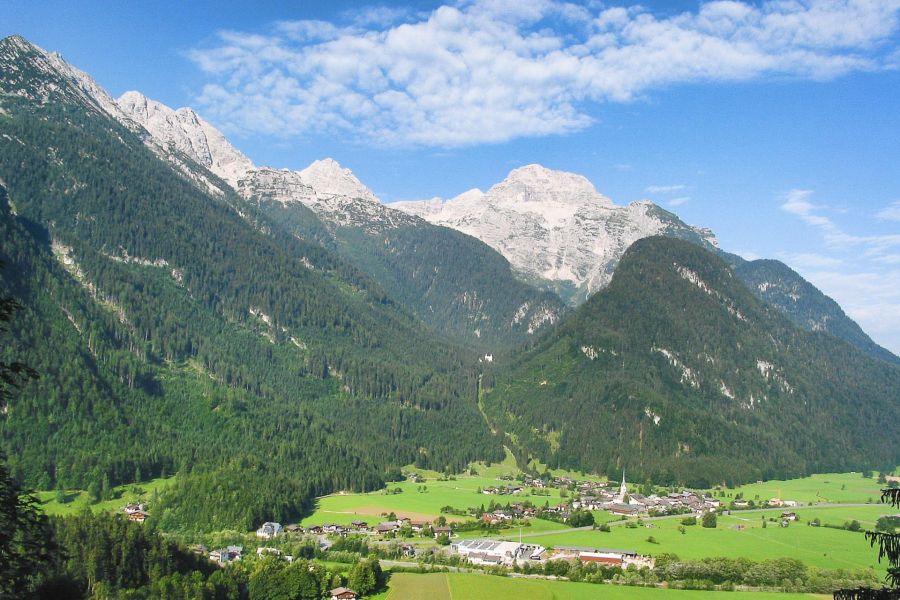
Here in Lofer in the heart of Salzburg’s Saalachtal - surrounded by mountain massifs such as the Loferer, Leoganger and Reither Mountains, the Waidringer Alps, the Steinernes Meer and the Hochkönig-massif - all mountaineers and climbers will find fabulous mountain tours and climbing routes of all levels of difficulty. Here both beginners as well as climbing pros climb towards the sky through fascinating and challenging cliff faces.
After your mountain or climbing tour, a relaxing session in thesauna or in the steam bath in Hotel "Zum Schweizer" is the perfect end to your day to get fit again for the next day’s tour.
Here are some suggestions for climbs and climbing routes/via ferratas in the region:
Description
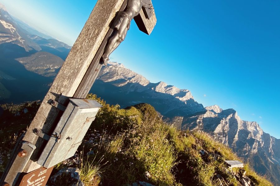
From Loferer high valley at the foot of the Steinberge Mountains follow the well signposted mountain path in switchbacks, first through the forest and then across alpine meadows and boulders to the Alpine Association’s mountain hut. The steep climb is rewarded with superb views of Loferer basin valley.
Highest point
1,966 m
Destination
Loferer high valley
Equipment
Sturdy footwear, good clothing (for sudden change in weather)
Safety notes
Remnants of snowfields may occur, especially during spring.
Tips
Note the seasonal opening times of the Schmidt-Zabierow-Hut.
In July the alpenrose is in bloom, transforming the mountain sides into a sea of red.
Type:
Challenging alpine hike
Altitude difference:
1,600 m over ascent and descent
Walking time:
Walking time: ca. 6 hours, descent ca. 4 hours
Fitness:
high requirements; recommended only for fit athletes
Technique:
Often trackless, exposed terrain, partly no trail markings. Increased risk of falling. Hands need to be used at times to move forward safely (climbing sections up to 2nd difficulty level acc. to UIAA). Sense of direction, surefootedness and a head for heights required.
Equipment:
Hiking gear
Directions
Parking lot Waltlmühlsäge (AlmErlebnisBus: Get off at Kallbrunnalm turn-off) - Kallbrunnalm - Diessbach reservoir
return either along the same route or Pürzlbach - Gasthof Lohfeyer Inn (AlmErlebnisBus-stop)
Highest point
1,470 m
Destination
Diessbach reservoir
Equipment
Hiking gear
Tips
Food and drink available at Kallbrunnalm snack station
Directions
From Pürzlbach parking lot follow Trail No. 411 up to Kallbrunnalm. At the first huts, turn left onto Trail No. 31. Past the alpine huts the trail leads across the meadows and up to Kühkranz Mountain at 1,811 m in switchbacks. From here, surefootedness is required. The trail leads from Kühkranz traversing gently downhill to the start of a gully secured with a steel rope. Follow the ropes steeply uphill, later through mountain pines as well as steeply up to the summit from the south for a short bit. Back along the same route, via Kallbrunnalm hut to Pürzlbach parking lot.
Highest point
1,953 m
Destination
Pürzlbach
Equipment
Hiking gear
Tips
Fabulous hike with food and drink available at Kallbrunnalm hut
Additional info
Food and drink available at Kallbrunnalm hut
Description
The tour up to Seehorn Mountain requires substantial endurance and good fitness. This mountain tour is rewarded with superb views of the surrounding peaks.
Duration:
- 1. 8-9 hours
Highest point
2,322 m
Equipment
Hiking gear, mountain boots, hiking poles recommended
Safety notes
Challenging mountain hike
Tips
If time and fitness allow, choosing the longer way down via Hochwies - Mitterkaiser Nature Park - Diessbach reservoir pays off. The unique natural setting is indescribably beautiful. Having arrived at the bottom you can refresh your tired feet in Diessbach reservoir, before returning to Pürzlbach parking lot via Kallbrunnalm.
Steinplatte 1,869 m / Loferer and Leogang Mountains
CHARACTER
Beautiful via ferrata in scenic surroundings. The path has some snappy passages and airy sections. Can be easily combined with a hike up to Steinplatte Mountain. If choosing Gamssteig (short via ferrata to the foot of the cliff) as approach, it makes for a beautiful and exciting circuit.
ADDITION TO THE DIFFICULTIES
One spot C, otherwise mostly around C/B and B
NOTE ON THE SAFEGUARDS
Very well secured with cramps and wire rope from start to finish. At times far between cramps, you need to use the natural rock structure as grip or footing.
APPROACH TO THE WALL
From St. Johann or Lofer to Waidring. Here you can either take the cable car or drive along the toll road up to Steinplatte Mountain.
APPROACH BY CABLE CAR
The approach via "Gamssteig" (25 m EG, the path will take you to the foot of the cliff, B/C) proceeds from/behind Gasthof Kammerköhr Inn. Do not follow the signs for Steinplatte here, but an unmarked trail in direction of the cliff face on the south side. The trail leads to a signboard, behind which path-tracks lead to "Gamssteig", climb down this for some 25 m down to one ledge and then east along the foot of the cliff face to the entry point of the "Schuasta Gangl"-via ferrata (entry at pillar, see below).
Approach with toll road (8 euro/car): From the parking lot "Skigebiet Steinplatte" to Stalleralm Lodge and continue on the hiking trail in direction of Wemeteigenalm. At the end of the forest road - after having passed below the gondola lift - a small path branches off uphill to the left, yellow sign “Klettersteig” (via ferrata) - follow this to the foot of the cliff face, now to the right (not to the left to the gondola lift) continuing to the entry point at the prominent rock pillar.
Mountains:
Mountain:
Götschstein (1,536 m)
Character:
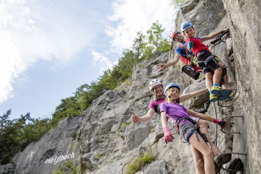
The Zahme Gams via ferrata is a short, rewarding beginners’ via ferrata right in the mountaineering village of Weissbach bei Lofer. The tour proceeds in the right part of the AV-climbing crag and is well secured with bolt hangers and steel rope. Can be ideally combined with romantic Seisenberg Gorge.
Difficulty:
In the middle ledge section and in the dihedral, short passages B/C, otherwise some passages B and A.
Child-friendly:
Yes
Equipment:
Full via ferrata equipment and helmet.
Note on the safeguards:
Well secured with steel rope and cramps. The safeguards are mounted in such a way that even smaller individuals have no problems reaching them.
Addition to difficulty:
Shorter sections B/C, mostly around B
Approach to the wall:
From the parking lot at Seisenberg Gorge across the bridge and left on the road for 100 m to a woodshed. Then turn right into the forest and via the path to Weissbach climbing crag. The entry point is located right at the climbing crag next to the information board.
Altitude of entry point:
700 m
Descent:
At the end of the rope straight upwards, then to the right on Jägersteig path. Follow this to the right for some 300 m, always along the edge (viewpoint with bench). Past a small hut down to the agricultural road and follow this back to the parking lot.
Remarks:
Somewhat more difficult to walk when it’s wet, slippery especially in the forest. At the bridge you’ll find a Kneipp facility, there is a playground at the parking lot.
Mountains:
Berchtesgaden Alps
Mountain:
Hochkranz (1,953 m)
Character:
Interesting valley via ferrata, which winds well through the heavily forested rock belt and features a considerable 130 m difference in altitude. The via ferrata has it all: A steep, slightly overhanging D-passage, beautiful ledges and long crossings - but there are also many earthy passages. Makes for a perfect Sunday outing, especially when combined with a visit to Seisenberg Gorge or Lamprecht´s Cave.
Difficulty:
In the lower part a slightly overhanging ledge must be climbed (D), in the upper part there are a couple of more difficult upswings (to C/D).
Equipment:
Full via ferrata equipment; a safety rope for weaker climbers.
Note on the safeguards:
Well secured with steel rope and cramps.
Addition to difficulty:
Short sections D and C/D, but mostly around B/C.
Approach to the wall:
From the parking lot near Gasthof Auvogl Inn in town, head south for a short bit until you get to the sealed road into Hintertal. Follow this for a few meters in direction of Hintertal, until at the end of the meadow to the right of the road you come upon a hiking trail (sheet metal tunnel below the road) in direction of Gasthof Frohnwies Inn. After a few minutes you get to the entry point at a signboard, well visible from the hiking trail.
Altitude entry point:
665 m
Descent:
From the end of the path walk along the markings on a path to the sealed road (there you’ll also find a children’s climbing crag). Follow this down to the left, left again at a crossroads and back to the parking lot at Weissbach.
Remarks:
The super fit can continue up to Hochkranz Mountain - the normal route is secured (sections B; ca. 1,100 EG/2.5 hrs. from the exit point). This short path can be well done in “passing”, as in Weissbach you should slow down a bit anyway - because this is where the most profitable speed trap in the state of Salzburg is located. The path can also be well combined with a visit to Lamprecht´s Cave (beautiful show cave) or with Seisenberg Gorge which begins right in the village. A good option for a mountain tour to follow is Hochkranz (short sections to B), you can drive up all the way to Pürzelbach, then on foot via Kallbrunnalm hut to the summit.
Mountains:
Berchtesgaden Alps
Mountain:
Hochkranz (1,953 m)
Character:
The Wilde Gams via ferrata is an extreme via ferrata in the mountaineering village of Weissbach bei Lofer. The ferrata requires lots of strength, which needs to be applied constantly for a full 25 m of elevation gain. Individual sections do not go beyond E/F, but full strength and endurance are required all the way to the exit point.
Those who make it from the ledge below the E/F overhang without resting in the via ferrata (also RF-style), will feel what the word endurance means on their lower arms. This via ferrata is surely one of the most difficult ones in Salzburg and is also for the first time a ferrata, on which the difficulty level E/F is not reached as a “variant”!
Difficulty:
The key sections are the overhang (E/E) and the subsequent long dihedral (E and E/F). An emergency exit (A) before the E/F-overhang offers an opportunity to abort.
Equipment:
Full via ferrata equipment and helmet. For newcomers in the upper difficulty range (E) absolutely a safety rope.
Note on the safeguards:
Very well secured with steel rope and cramps.
Addition to difficulty:
First section around D, the second part significantly more difficult, longer E/F
Approach to the wall:
From the parking lot at Gasthof Frohnwies Inn, follow the cycle path for a short bit in direction of Saalfelden. After about five minutes you’ll get to a cattle fence, with a few steps to the left before it to the cliff face (entry just right of the fence).
Altitude entry point:
665 m
Descent:
From the exit point keep left and follow the edge on vestiges of a trail for a short bit to the so-called Quellensteig (source path), which runs down to the left to the cycle path (inconspicuous trail remnants, secured with ropes at the exposed passages). On the path down to the cycle path and back to Gasthof Frohnwies Inn.
Remarks:
Difficult to walk when wet, the descent on Quellensteig is then also dangerous (steep terrain with leaves).
Please note:
Currently, parking at Frohnwies Inn is tolerated. Ideally, this is also where you then stop off for some food and drink afterwards.
Berchtesgaden Alps
Mountain:
Hochkranz (1,953 m)
Character:
The "Kids Gams" is a classic beginners’ via ferrata, and that in the heart of the mountain near the village of Weissbach bei Lofer. The ferrata is ideal for surviving initial contact with the wire rope without any major problems. Those who choose the "Angsti & Fürchti (fear & fright)-variant“, will get into slightly more exposed rocky terrain with the same difficulty as the normal route (B). Various information boards along the 180 m of steel rope provide additional details while climbing upwards along the small ridge at the south-eastern outskirts of Weissbach. A well-designed beginners’ via ferrata.
Difficulty:
There are two short B-sections. One at the end of the “fear & fright-variant” and another one all the way up at a boulder.
Equipment:
Full via ferrata equipment and helmet.
Note on the safeguards:
Very well secured with cramps and wire rope.
Addition to difficulty:
Two short passages B, otherwise mostly around A/B and A.
Approach to the wall:
From the parking lot at Gasthof Auvogel Inn, follow the sealed road in direction of Prüzelbach. Where the forest begins to the right, turn off to the right onto a trail, then walk through a wooden gate, and before the second wooden gate the trail leads steeply uphill to the left to the entry point.
Descent:
From the exit point through the forest on the marked trail to a gravel road. Keep to the left on this, to get to the sealed road in direction of Pürzelbach. Follow this downhill, back to the starting point in Weissbach bei Lofer.
Remarks:
Mountains:
Loferer and Leoganger Mountains
Mountain:
Schafelberg (1,597 m)
Character:
Short via ferrata above the little St. Adolari Church. This beautiful tour runs through a climbing crag and has a zip wire as a grand finale. The via ferrata is interesting even in not so safe weather thanks to its short approach and descent - nearby Lake Pillersee is also great for swimming or hiking. Right at the parking lot you’ll find a nice inn to stop off at.
Exact route description:
At a pillar until you get to the suspension bridge, then continue to a platform. There, either slide along the zip line or exit next to it.
Equipment:
Full via ferrata equipment and helmet
Note on the safeguards:
Secured with steel rope - some of the safeguards and boardwalks seem a little rickety.
Addition to difficulty:
Often B/C, rarely easier.
Approach to the wall:
From the chapel follow the forest road for a short while in direction of Rechensau. Where the trail meets the rocks, the path begins along the climbing crag to the entry point at a wooden platform.
Altitude entry point:
930 m
Descent:
After the zip line, zigzag down a path back to the entry point and then walk on the approach path to the parking lot.
Remarks:
This tour is also suitable for beginners who are not frightened. But the suspension bridge wobbles a little. You should only use the zip line if you are familiar with such (no hands on top of the suspended steel rope).
Mountains / Touring area:
Loferer Mountains
Highest point:
2,511 m
Characteristic:
Very athletic tour up to the central summit of the Loferer Mountains
General level of difficulty:
difficult
Fitness requirements:
very demanding
Distance / difference in altitude:
19 km / 1,885 m
Time required:
10.5 hours
Exposedness of the tour:
exposed
Equipment:
Good footwear, alpine rescue gear
provisions / staging posts:
Schmidt-Zabierow-Hut (4.0 hrs.)